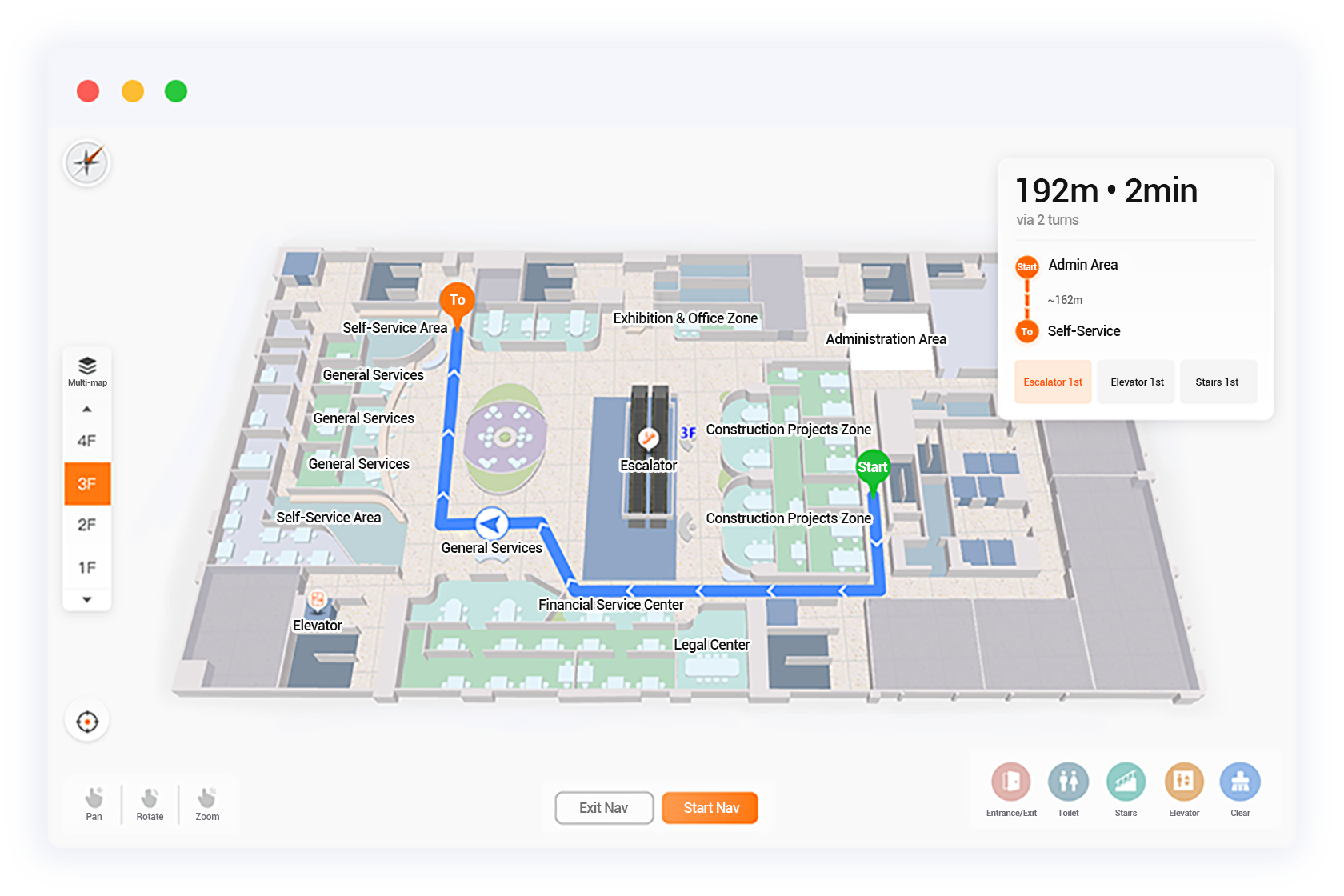
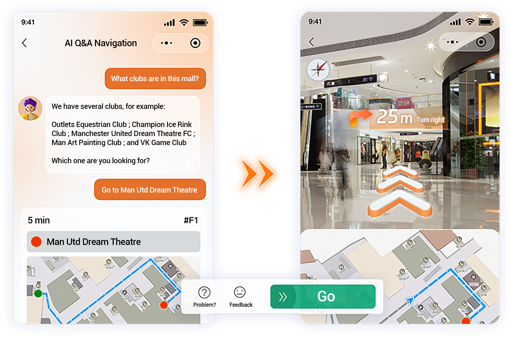
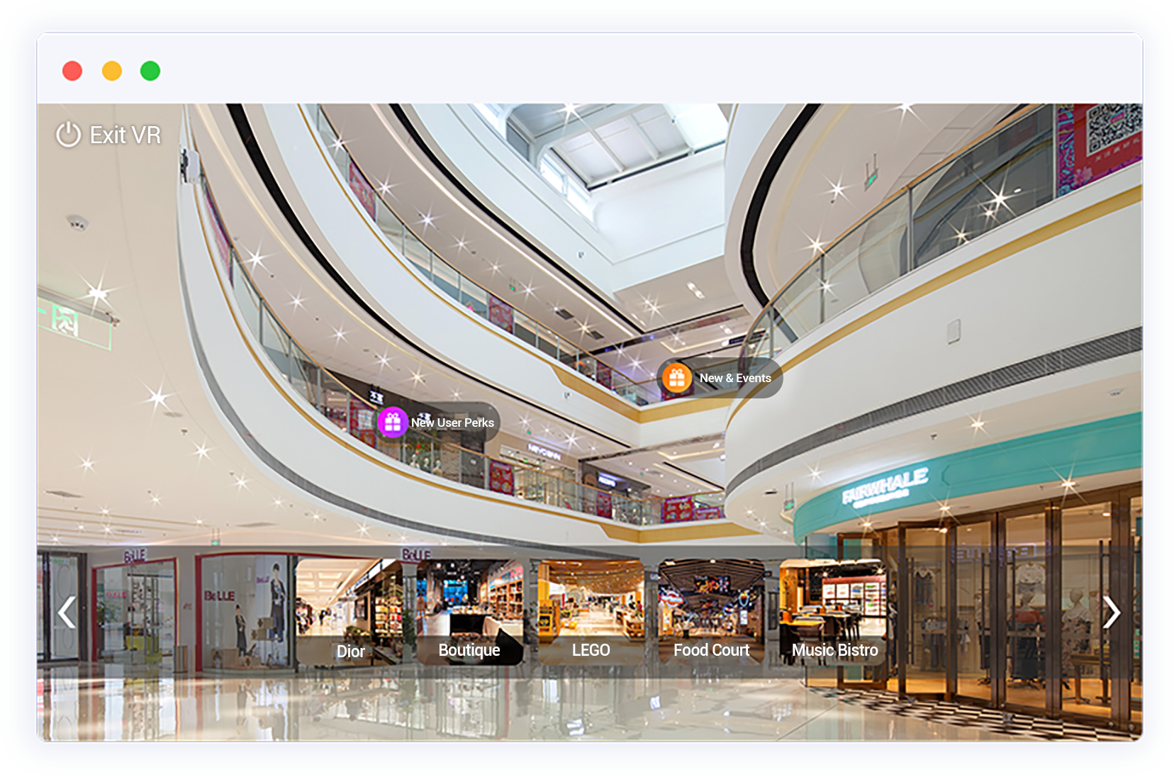
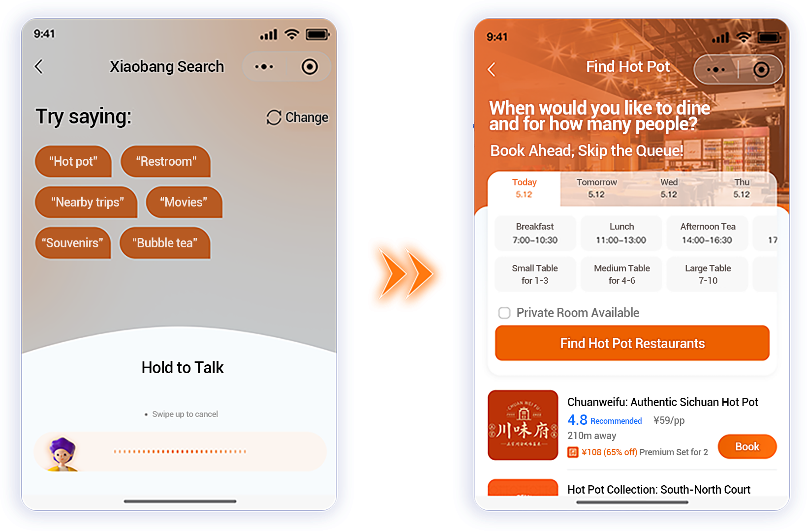
Build a 3DVR map system and business data management platform for the mall, providing intelligent guidance services for consumers throughout the mall, and providing scientific data for the mall's activity marketing and operation decision-making, promoting the digital upgrade and transformation of the mall.
![]()
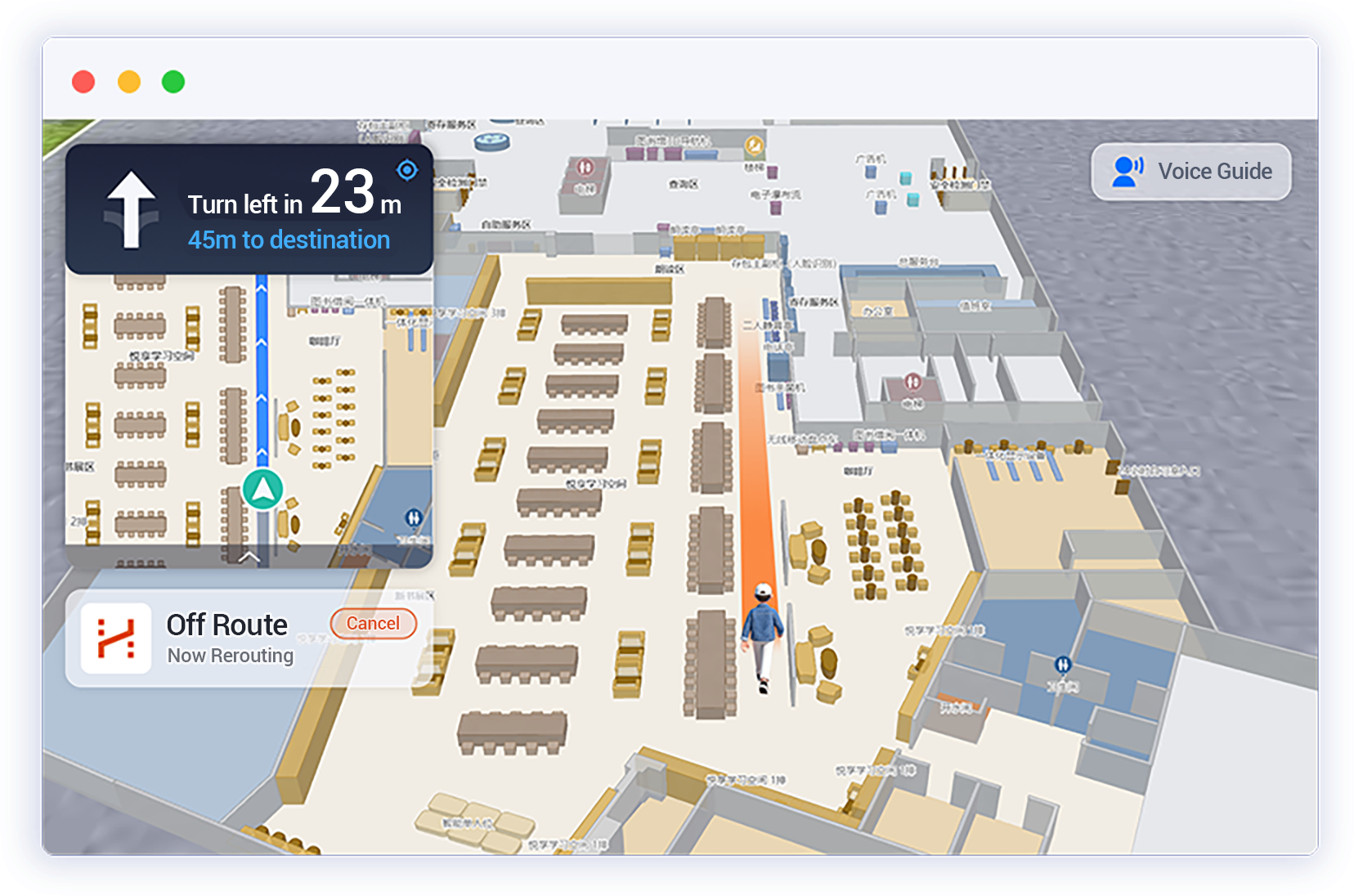
3D Floor Navigation
![]()
Electronic Screen Guidance
![]()
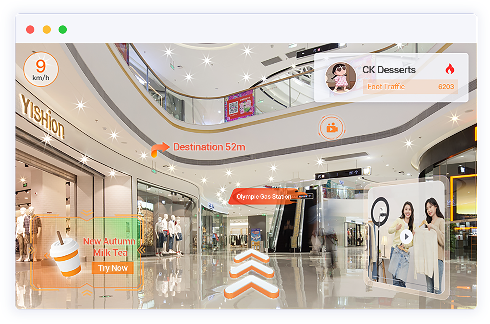
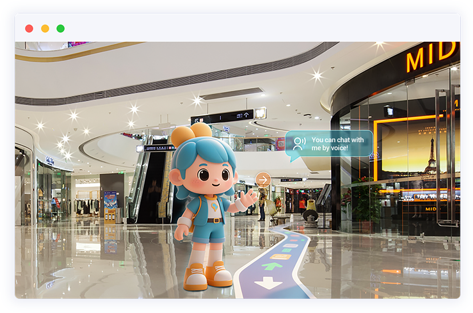
AR Navigation Marketing
![]()
VR Panoramic Store
![]()
Reverse Parking
![万达]()
Wanda Plaza
![时尚天河]()
Guangzhou Fashion Tianhe
![东盟]()
ASEAN Expo
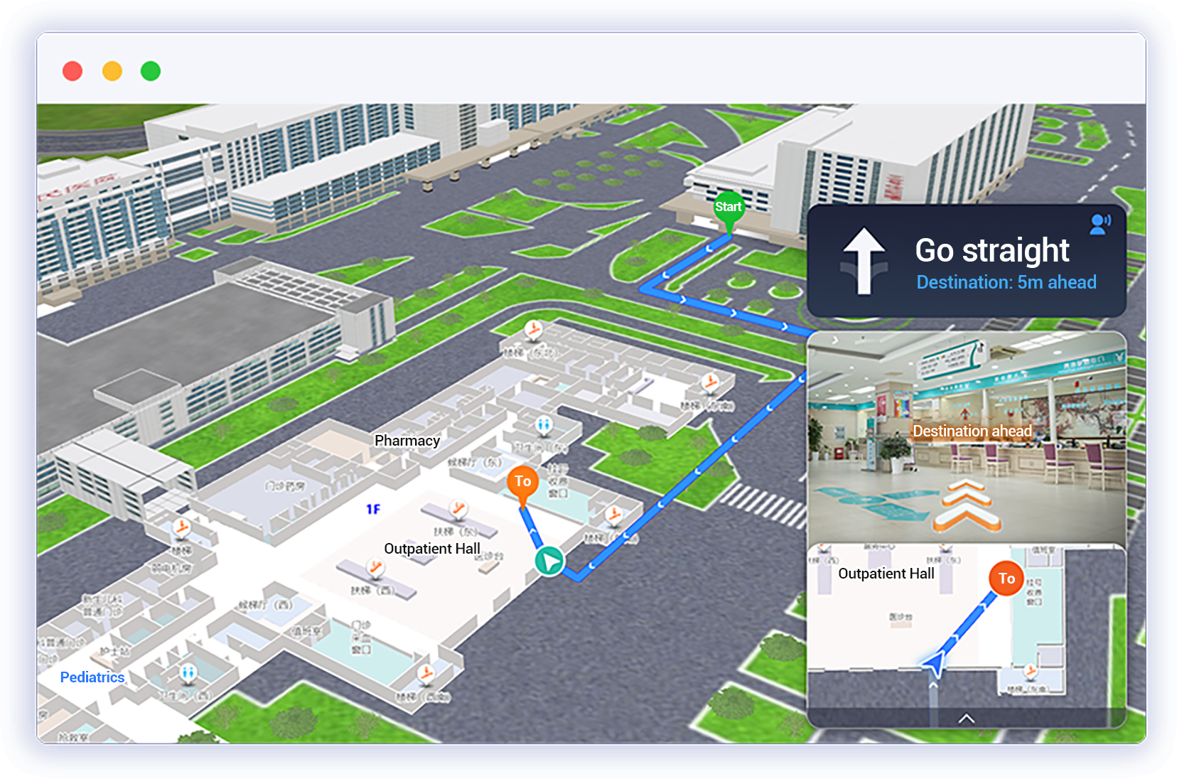
According to the requirements of smart hospital "Level 3" construction, realize intelligent navigation, smart consultation, online appointment and other services within the hospital, helping patients quickly find their destination and reduce waiting time for medical treatment.
![]()
In-hospital Navigation
![]()
Smart Navigation
![]()
AR Navigation Marketing
![]()
AR&VR Navigation
![]()
Integrated HIS System
![]()
Reverse Parking
![苏州人民医院]()
Suzhou Fifth People's Hospital
![淮安人民医院]()
Huaian First People's Hospital
According to the requirements of smart scenic construction, based on map applications, develop smart navigation, smart guidance and other services, achieving precise引流 of scenic spots online, improving the tourism experience of visitors, and assisting scenic marketing and customer acquisition.
![]()
Hand-drawn Map
![]()
GPS Positioning Navigation
![]()
Scenic Spot Voice Explanation
![]()
VR Panoramic Tour
![]()
Personalized Route
![四角井]()
Si Jiao Jing Cultural Street
![兰溪古镇]()
Lanxi Ancient Town
![碧桂园]()
Binyan Forest Lake
Build 3D electronic maps, book location navigation, VR panoramic guidance navigation and other library digital applications, providing intelligent guidance services for the entire borrowing process, improving readers' reading experience.
![]()
3D Navigation System
![]()
Book Location Positioning
![]()
Library VR Cloud Tour
![]()
Seat Reservation Navigation
![]()
Operation Decision Big Data
![金华城市书房]()
Jinhua City Library
![河南职校图书馆]()
Henan Vocational College Library
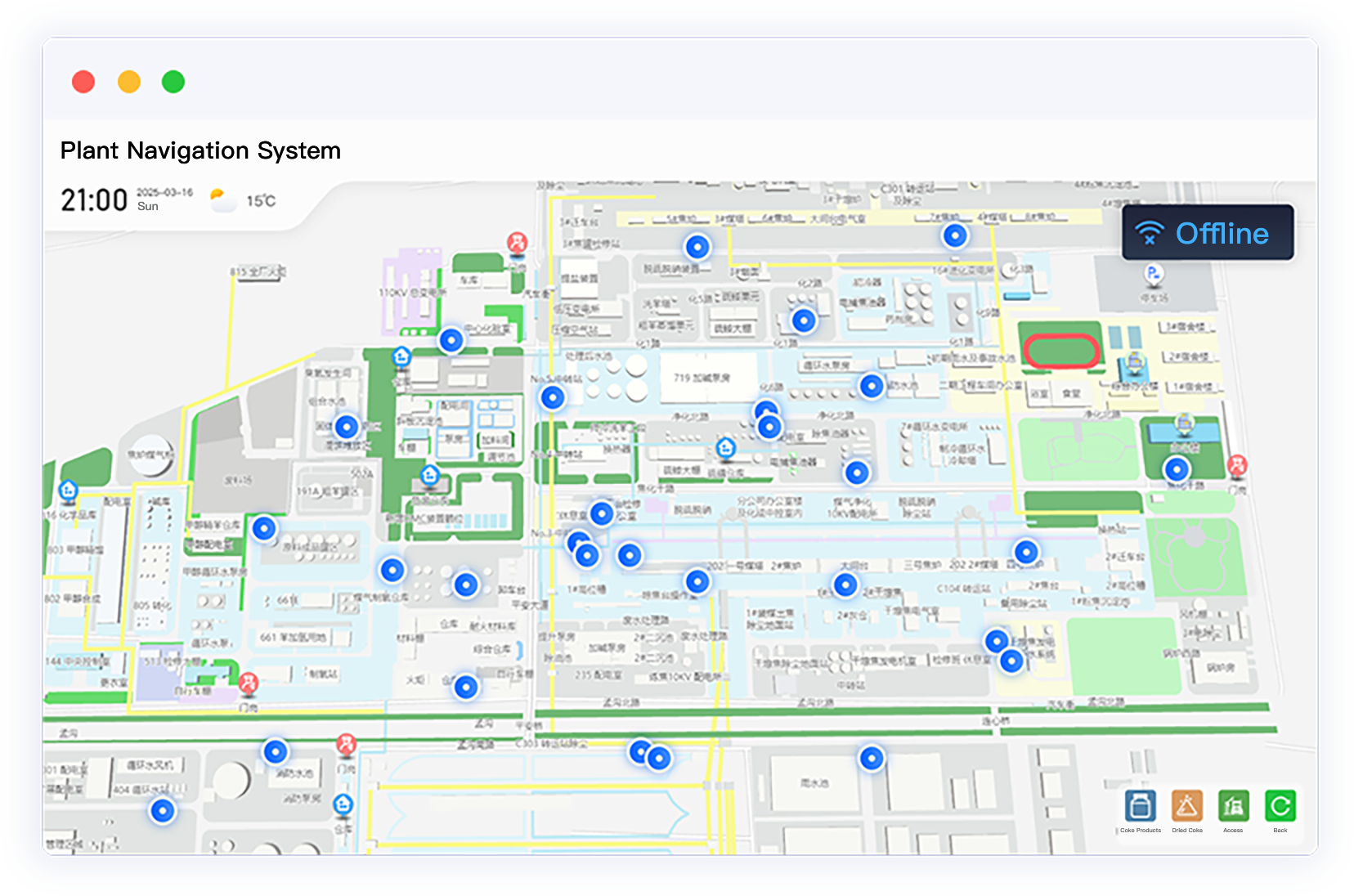
Build park electronic maps, combining GPS positioning and Bluetooth positioning, realize indoor and outdoor positioning navigation, personnel and vehicle positioning, power fence and other applications, improving the passage efficiency of vehicles and personnel, and reducing safety risks from outsiders.
![]()
Park Positioning Navigation
![]()
AR Real-scene Navigation
![]()
Reverse Parking
![]()
Indoor Bluetooth Navigation
![]()
Electronic Fence
![滨湖万丽]()
Binhu Wali Community
![国某电力]()
Guo Network Power Company
Through government electronic map navigation, AR navigation, intelligent customer service and other applications, help the public quickly find service windows, improve service efficiency, and achieve "one-time business processing".
![]()
3D Intelligent Navigation
![]()
AI Intelligent Customer Service
![]()
VR Government Guidance
![]()
Reverse Parking
![]()
Operation Decision Big Data
![山西政府办公楼]()
Shanxi Provincial Government Office
![临汾服务中心]()
Linfen City Convenience Service Center
Through GPS and map engine integration, provide integrated positioning and navigation services for personnel and vehicles, reducing the time for trucks to find routes for unloading and loading, and improving the transportation efficiency of factory trucks.
![]()
Vehicle GPS Navigation
![]()
Visitor Positioning Navigation
![]()
AR Navigation
![]()
VR Navigation
![]()
Electronic Fence
![国某电力]()
Guo Network Power Company
![上海宝钢]()
Shanghai Baogang Park
Based on Weigou's independently developed positioning and graphics engine, using Bluetooth positioning and AR technology, build a digital exhibition hall guidance platform, providing intelligent tour experience for visitors.
![]()
Bluetooth Positioning Navigation
![]()
AR Navigation
![]()
AR Guidance
![]()
VR Panoramic Tour
![]()
Intelligent Voice Guidance
![]()
Location Sharing
![安庆博物馆]()
Anhui Anqing Museum
![龙华少年宫]()
Shenzhen Longhua District Youth Palace
![东盟]()
ASEAN Expo
Using Weigou's independently developed map engine, integrating 3D navigation, VR tour, scenic spot explanation, and visualized management into a smart platform, assisting in the construction of the campus digital image.
![]()
Campus 3D Map
![]()
Campus Positioning Navigation
![]()
Campus VR Tour
![]()
Digital Education
![]()
Visualized Management
![无锡实验学校]()
Jiangsu Wuxi Chun Cheng Experimental School
![河南职业技术学校]()
Henan Vocational College Library
Using mini-programs and all-in-one machines as carriers, through one-stop AI guidance navigation services, simplify procedures, reduce the time for finding departments, and improve public satisfaction in handling affairs.
![]()
3D Intelligent Navigation
![]()
AR Navigation
![]()
AI Intelligent Customer Service
![]()
Personnel Positioning
![]()
Reverse Parking
![新沂人民法院]()
Xinyi City People's Court
![山西政府办公楼]()
Shanxi Government Office
Using 3D technology to restore booth layout, realizing booth online booking, booth quick navigation and query functions, reducing the time for attendees to find routes and parking, and improving the efficiency of business development.
![]()
3D Map Navigation
![]()
AR&VR Navigation
![]()
Reverse Parking
![]()
Location Sharing
![]()
Peripheral Services
![东盟]()
ASEAN Expo
![安庆博物馆]()
Anhui Anqing Museum
![龙华少年宫]()
Shenzhen Longhua District Youth Palace
Construct indoor maps of transportation hubs, provide 3D-AR navigation services, solve the problem of passengers finding places and people, reduce the occurrence of personnel congestion, and improve the service level of hubs.
![]()
3D Map Navigation
![]()
AR&VR Navigation
![]()
Crowd Heat Map
![]()
Location Sharing
![]()
Peripheral Service Navigation
![贵阳北站]()
Guiyang North Station
Build digital indoor maps of airports, provide flight route queries, quick navigation of infrastructure and other services, reducing the time for passengers to find routes and parking, and improving the service level of airports.
![]()
Airport Map Navigation
![]()
AR&VR Navigation
![]()
Peripheral Service Navigation
![]()
Reverse Parking
![]()
Location Sharing
![贵阳北站]()
Guiyang North Station