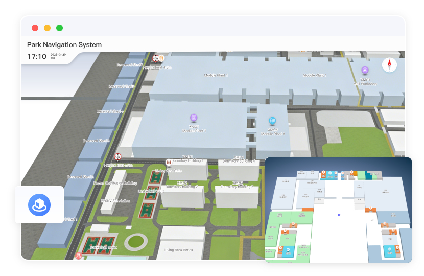
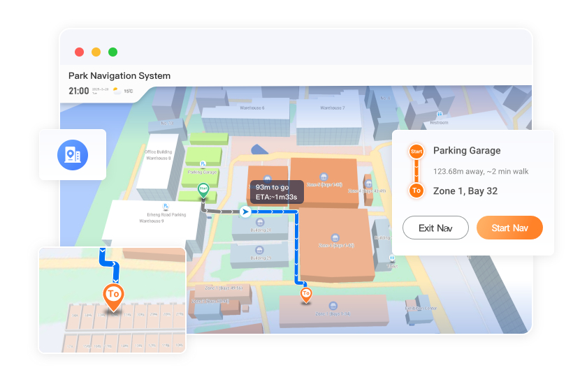
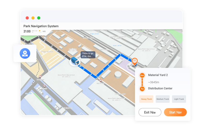
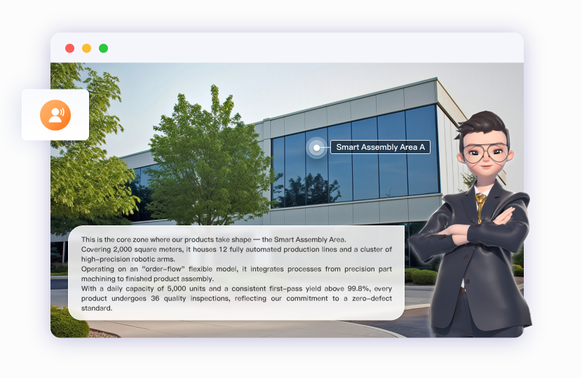
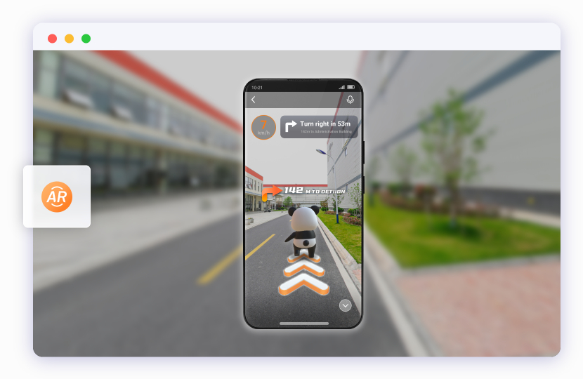
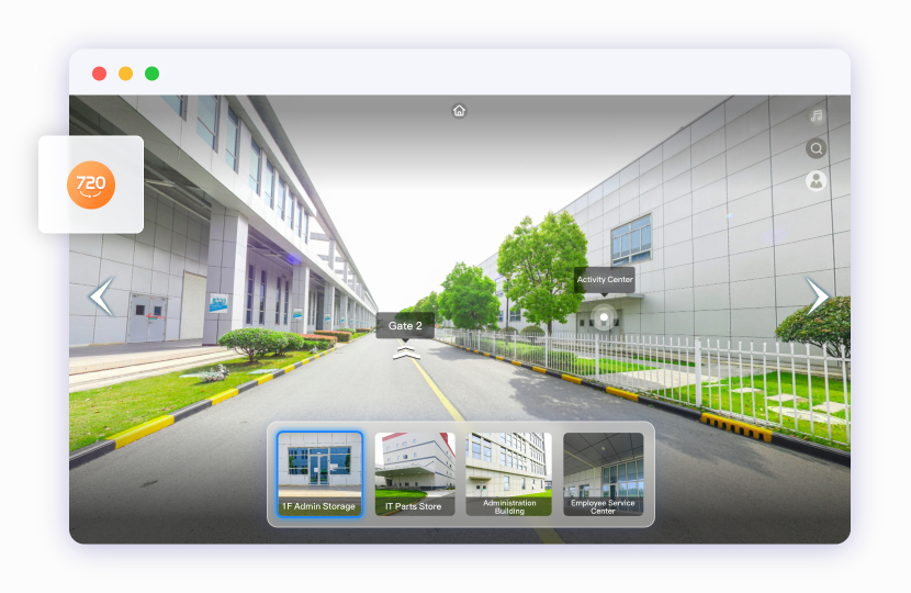
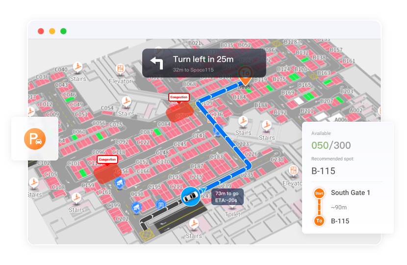
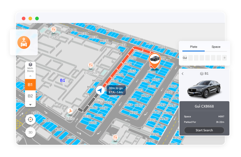
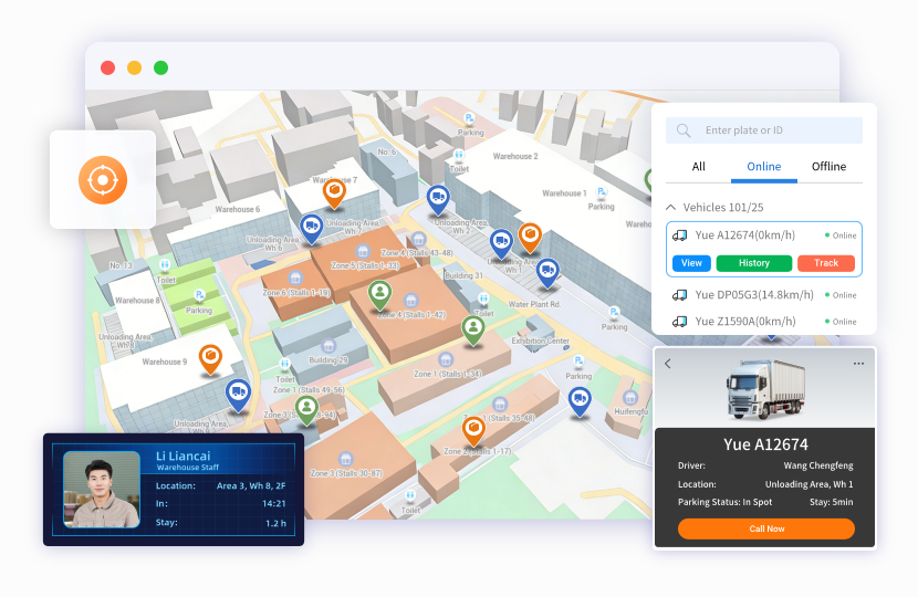
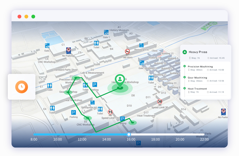
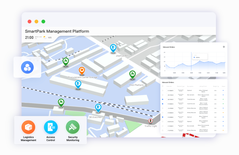
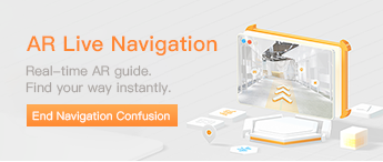
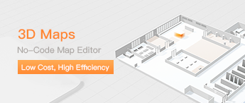
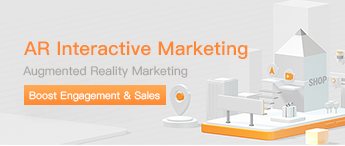
Smart 3D Maps Lead the Way for Smooth Traffic

Seamless Indoor–Outdoor Modeling with Smart Route Planning

  • Indoor–Outdoor Map Modeling

    Construct detailed 3D maps including building structures, floor layouts, and road landscapes.

  • Seamless Indoor–Outdoor Navigation

    Bluetooth positioning combined with GPS provides seamless navigation across buildings and floors with precise routing.

  • People/Vehicle Navigation

    Real‑time walking routes for visitors/staff and dedicated vehicle routes that avoid restricted areas.

Try Now

AI + AR/VR for Immersive Smart Park Tours

  • AI Digital Human Commentary

    Large‑model powered, vivid and humanized commentary increases immersion while conveying brand value and innovation.

  • AR Navigation

    Overlay digital human arrows and distance prompts on the camera view for intuitive 3D guidance.

  • VR Tours

    720° online panoramas to freely view building layouts and facilities and plan routes in advance.

Smart Reverse Car‑Finding: One‑Tap Ease

  • Parking Navigation

    Dynamically guide vehicles to available spaces, showing distance/direction in real time while avoiding congestion.

  • Reverse Car‑Finding

    Enter plate or space number on exit to generate a walking route from the current position to the car.

AR Reverse Car‑Finding

Accurate People/Vehicle Positioning with Efficient Integrations

  • Real‑Time Positioning

    High‑precision Bluetooth positioning quickly locks people and vehicle locations for timely dispatch and management.

  • Historical Trajectory

    Record complete historical tracks for review to understand movement ranges and support decisions.

  • Third‑Party System Integration

    Seamlessly integrate with security, access control, logistics, and more for data interoperability and function extensions.

Get API Docs
System Highlights

Integrated Positioning & Navigation for People/Vehicles

In‑house positioning and map engines with active/passive data fusion for rapid navigation development

One Map, Many Applications

With mature SDKs & APIs, reuse one map for navigation, positioning, and data/asset visualization

Flexible Hybrid Deployment

Support private/public/hybrid cloud with SaaS delivery for security and usability

Integrate Third‑Party Maps

Overlay in‑house maps on third‑party maps to seamlessly connect outdoor GPS with indoor Bluetooth navigation

Offline Positioning & Navigation

Offline deployment works without network/signal; navigation, positioning, and routing function normally.

Classic Cases
案例
Xiamen Times Park
GPS Navigation
As an innovation engine in the new energy industry, Xiamen Times leverages CATL’s technological strengths with smart production and green manufacturing to build a world‑leading battery R&D and manufacturing base. With GPS navigation, it achieves intelligent vehicle route planning, boosts transport efficiency by 30%, and reduces logistics costs and carbon emissions—becoming a regional benchmark for digitalization.
案例
Guanghong Food Park
AR Live NavigationGPS NavigationVR Park
As a model smart park, the “Sheng Leng Tong” system integrates AR live navigation, GPS navigation, and VR park modules to build a merchant marketing platform. It showcases frozen‑goods shops, products, and promotions, improves procurement efficiency via precise source matching and route planning, and helps enterprises transform into digital supply chain service providers.
案例
Binhu Renaissance Community
Refined 3D Model MapReal‑Time PositioningFast Infrastructure Navigation
Using refined 3D maps, smart route planning, and real‑time positioning, it delivers high‑precision pedestrian navigation to help new residents and visitors quickly understand the community and surroundings. It provides one‑stop digital services to build a modern, smart living environment that is safe, comfortable, and convenient.
案例
Beijing Jingyang Park Cemetery
Hand‑Drawn MapGPS + AR NavigationCemetery System Integration
The smart guide system addresses challenges of a 600‑acre cemetery—difficult positioning, outdated information, and weak management—by integrating hand‑drawn maps, GPS, AR navigation, and management system connectivity to enable precise grave finding, immersive navigation, and real‑time updates, enhancing visitor experience and operational efficiency.
Related Recommendations
Free access to materials